HIGH-RESOLUTION AERIAL PHOTOGRAPHY
We employed the use of the following platforms: fixed-wing aircraft, helicopters, unmanned aerial vehicles (UAVs or "drones"), in taking of photographs of the earth surface from an elevated/direct-down position using a high-resolution camera triggered remotely automatically.
Aerial photography is - as it sounds - is the process of taking photographs from the air, but there is more to it than simply using fixed-wing aircraft, helicopters, unmanned aerial vehicles (UAVs or "drones"), and flying up to take photographs.
There are many elements to an aerial survey that must be considered to ensure that the data is useful enough to extrapolate whatever is being investigated. It is often difficult to see elements of the landscape on the ground, features can easily be missed, and what might seem like an insignificant bump from ground level can become more significant in a wider context; some landscape types are difficult to access on foot so aerial photographs are vital to study and map them. Its applications today are broad and coupled with the growing technology of GIS (Geographic Information Systems), the potential means that the method will not become obsolete any time soon.
Here at Interspatial Technologies, we help in acquiring and processing high resolution digital aerial photographs which find application in the following areas:
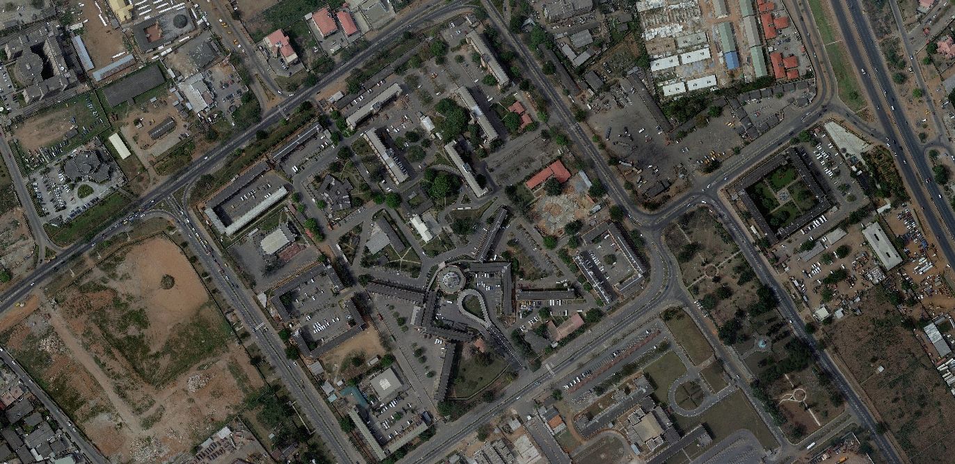
Urban Planning and Development
Town developers need to study the impact of the expansion and development of urban centers on the landscape and the impact on the environment. New facilities (for example a new sports stadium) will require a rethink of the infrastructure and the impact that the new facility will have on people living in the area - will we need to build more houses? Upgrade the roads? Will this affect protected areas? With aerial photography taken at low levels is vital to examining the existing infrastructure.
Climate Change Monitoring
We all know about the effects of climate change on global temperatures. These global changes are reflected everywhere, and societies and communities are seeing changes to their local environment. If it isn't river beds drying up, droughts getting longer, wetter seasons getting wetter and the reduction of inland lakes drying up completely, one of the most practical applications is tracking of invasive species into water bodies that just a few years ago would not have provided an adequate environment for those species.
Here at Interspatial Technologies, we help researchers keep vital records of changes over seasons and years to track local effects of climate change and risks to local ecosystems by providing high-resolution aerial photography.
They can also be used to study the process of natural changes, such as variations in soil and geology over time as well as changes to the underlying ground that leads to disasters such as landslides. Not quite as useful to geologists due to the relative expense and difficulty in interpretation compared to archaeological applications, aerial survey nevertheless has uses and benefits and the historical record for changes to the natural landscape is vital to understanding how the landscape may change in the future. Annual rainfall, whether lower or higher than normal, can have far-reaching consequences and it is this where geology's interests in aerial photography are most important.
Though increasingly taken over by satellite images and digital mapping of GIS in recent years, aerial photography still has some practical applications for finding mineral and fuel deposits, mapping areas and tracking geological changes and water management as well as general geological research those other applications cannot contribute to. A great example of this is water drainage ahead of proposed new urban developments - flood plain risks and subsidence mapping.
