Complete Geomatics Solutions Company
We are the best provider of High Resolution Image in West Africa!
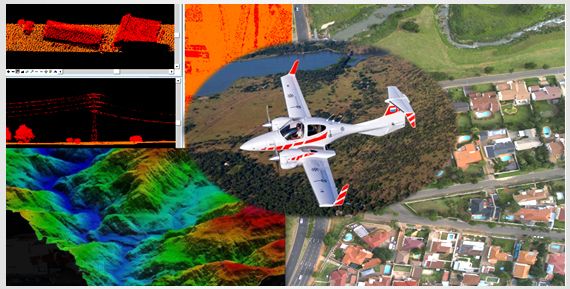
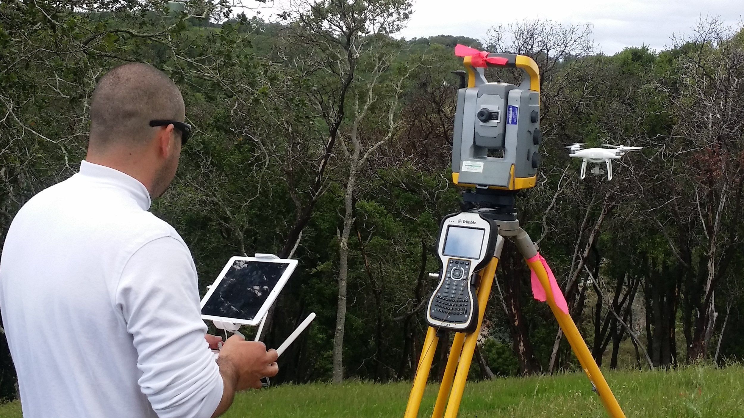
AERIAL AND TERRESTIAL LIDAR DATA AQUISITION
We adopted terrestrial scanning services from early-on in its commercial viability and have become expert practitioners in its use. Our considerable experience with its complexities provides a real advantage for our clients.
HIGH-RESOLUTION AERIAL PHOTOGRAPHY
We employed the use of the following platforms: fixed-wing aircraft, helicopters, unmanned aerial vehicles (UAVs or Drones), in taking of photographs of the earth surface from an elevated/direct-down position using a high resolution camera triggered remotely automatically.
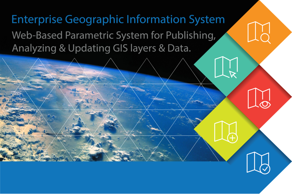
ENTERPRISE WEB-GIS DEVELOPMENT
Web GIS is a type of distributed information system, comprising at least a server and a client, where the server is a GIS server and the client is a web browser, desktop application, or mobile application. In its simplest form, web GIS can be defined as any GIS that uses web technology to communicate between a Server and a Client.
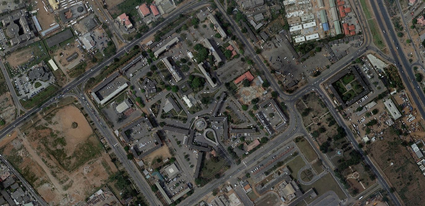
SURVEYING AND DIGITAL MAPPING
Here at Interspatial Technologies we employed the recent trends in digital technologies in mapping urban areas and an expert in using these new technologies for creation of a digital database for generating an urban resource information system.
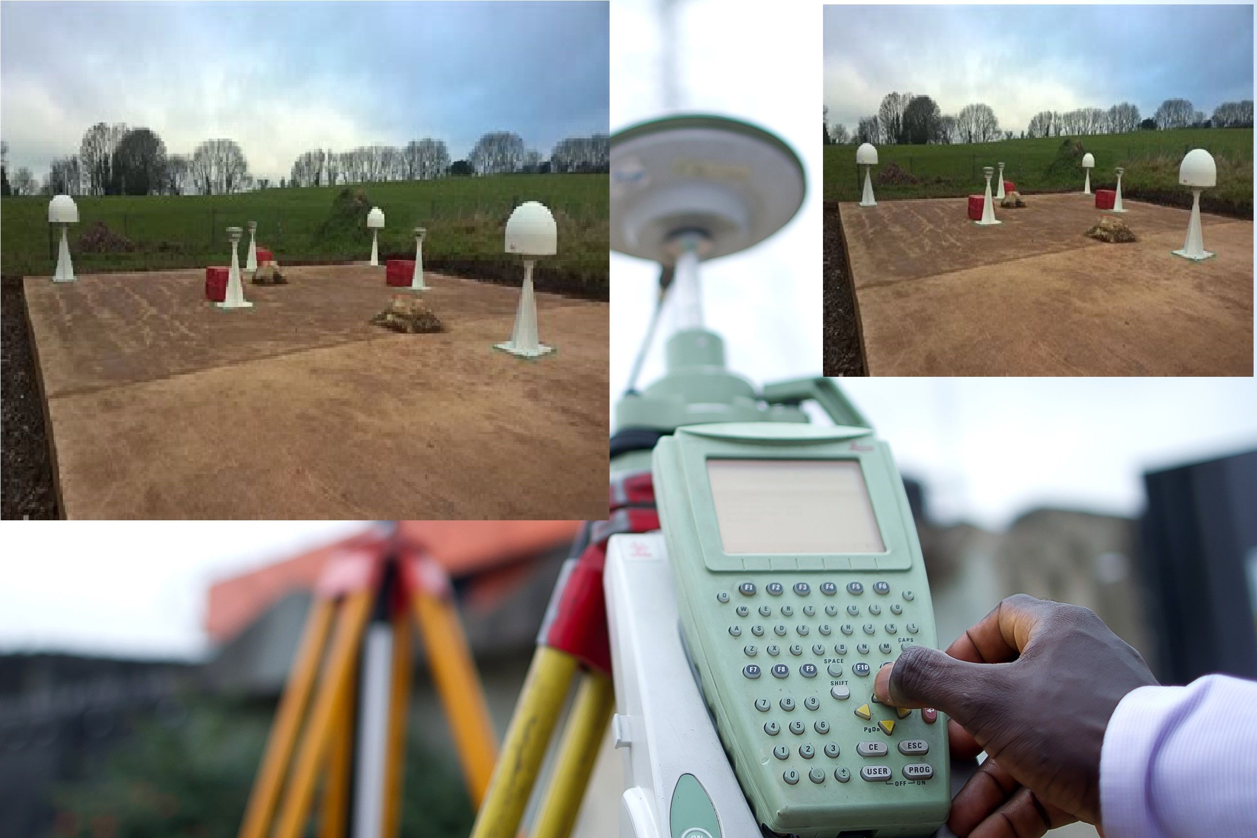
GEODETIC CONTROL SURVEYING
We provide a geodetic reference framework forming the spatial foundation for the creation of any Land-Information System (LIS). This consist of monumented points whose locations have been accurately determined with respect to a mathematical framework, this system permits the spatial referencing of all land data to identifiable positions on the Earth’s surface.
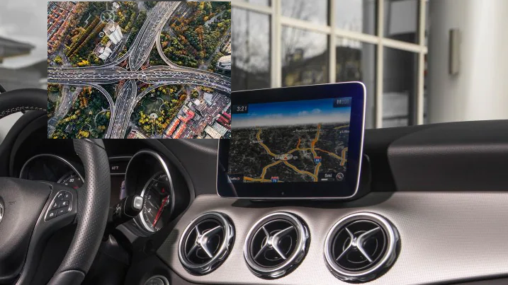
GEO-SMART NAVIGATION SYSTEM
Our reliable, full-featured GPS navigators take the doubt out of driving. As you make your daily commute or embark on a highway adventure, our navigators are here to help. They can even provide driver alerts to help increase awareness. Find what you need, and get where you’re going with ease.
Interspatial Technologies
Complete Geomatics Solutions Company
We expand Geospatial Possibilities through high quality,
Cost-effective, and Efficient Geospatial Services.
HIGH-RESOLUTION AERIAL PHOTOGRAPHY
HIGH-RESOLUTION AERIAL PHOTOGRAPHYWe employed the use of the following platforms: fixed-wing aircraft, helicopters, unmanned aerial vehicles (UAVs or "drones"), in taking of photographs of the earth surface from an elevated/direct-down position using a high-resolution camera triggered remotely automatically.
ENTERPRISE WEB-GIS DEVELOPMENT
ENTERPRISE WEB-GIS DEVELOPMENTWeb GIS is a type of distributed information system, comprising at least a server and a client, where the server is a GIS server and the client is a web browser, desktop application, or mobile application. In its simplest form, web GIS can be defined as any GIS that uses web technology to communicate between a Server and a Client.
GEODETIC CONTROL SURVEYING
GEODETIC CONTROL SURVEYINGWe provide a geodetic reference framework forming the spatial foundation for the creation of any Land-Information System (LIS). This consist of monumented points whose locations have been accurately determined with respect to a mathematical framework, this system permits the spatial referencing of all land data to identifiable positions on the Earth’s surface.
BIG DATA MINING EMPOWERING GIS APPLICATION
Application of Spatial Data Mining techniques in GIS application help describing a regular change of non-spatial attributes when moving away from certain start objects.
SURVEYING AND DIGITAL MAPPING
Here at Interspatial Technologies we employed the recent trends in digital technologies in mapping urban areas and an expert in using these new technologies for creation of a digital database for generating an urban resource information system.
Our Partners

Our Address
9A, Longe Street,
Off Lateef Jakande Road, Ikeja,
Lagos State, Nigeria
Contacts
Email: [email protected]
Phone: + 234 8083753738
WhatsApp:
+
234 7029351071
Social Media Platform
Interspatial Technologies