SURVEYING AND DIGITAL MAPPING
Here at Interspatial Technologies we employed the recent trends in digital technologies in mapping urban areas and an expert in using these new technologies for creation of a digital database for generating an urban resource information system.
SURVEYING AND DIGITAL MAPPING
Here at Interspatial Technologies we employed the recent trends in digital technologies in mapping urban areas and an expert in using these new technologies for creation of a digital database for generating an urban resource information system.
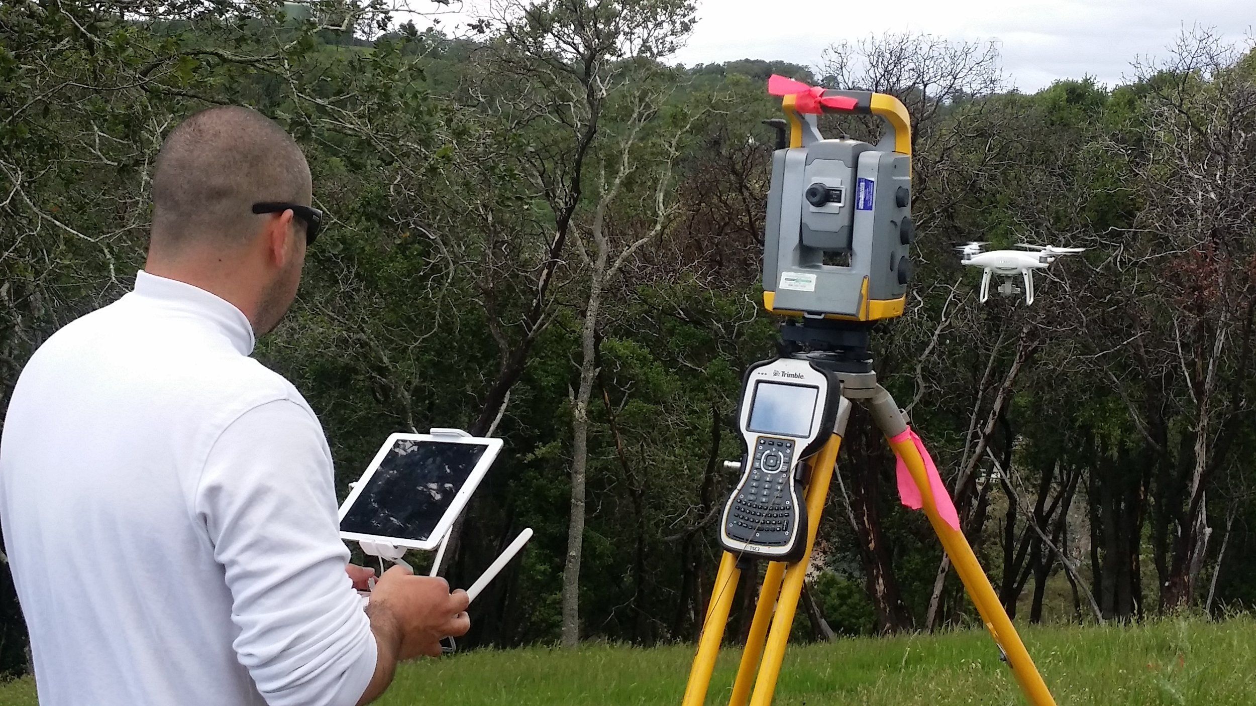
Surveying the way we measure the earth's constants, has changed in recent years with the rapid technological evolution. The time of surveying with purely optical and mechanical instruments (steel meter, levels, theodolites, etc) has rapidly been replaced with more sophisticated surveying techniques and equipment like motorized total stations, GPS, etc. Digital technology has also penetrated all aspects of the mapping process, from raw data collection through map compilation and design to final production. Advancement in mapping technology has replaced conventional stereo plotters with digital imaging systems. Technological advancements have made map-making more efficient and accurate.
To cope up with the challenges in the urban environment due to the rapid rate of urbanization needs proper planning and management, which in turn requires up-to-date digital spatial information. Remote Sensing technology ensures the free flow of an unlimited stream of data to be used for multifaceted applications.
The advent of high-resolution satellite data coupled with stereo capabilities has resulted in better mapping with higher accuracy. The recent launches of high-resolution (less than 1m) satellite systems have opened up new vistas for digital mapping at a large scale for cartographic applications. In addition to this, new technologies, such as advanced digital image processing, Global Positioning System (GPS) providing positional information within cm accuracy and Geographic Information Systems (GIS), LIDAR, InSAR, etc can be used to integrate and process spatial data for applications ranging from basic mapping to supporting resource exploration and development; from environmental management to the planning and administration of transportation and telecommunications systems, utility infrastructures, urban development, and land use.
These advanced technologies can very effectively be used to handle the present-day complex urban problems related to optimum utilization of available resources and infrastructure management.<>Here at Paragon Geomatics Solution, we employed the recent trends in digital technologies in mapping urban areas and an expert in using these new technologies for the creation of a digital database for generating an urban resource information system.
